November 8, 2010

Road To Kasaragod

Off late our bike rides are finding very few takers , and considering the number of disastors happening in the last few months one wouldnt blame them. More or less this has not been a good year for biking, with only 3 successful bike trips(including this one) against 7 last year. For this ride to Kasargod too we had a hard time getting the number of bikers to a respectable number, not that the guys are less enthuiastic about biking, various circumstances like being out of the country , not getting the necessary permission from home etc etc. In the end we had 4 guys ready for the bike trip (Manju, Santhosh, Nagesh and Myself) on 3 bikes.

The plan was to go to Kasaragod via Bhagamandala and come back via Hassan completing a circle at reaching Bangalore. I had been to most of the sight seeing places we had planned , since my moms hometown is very close to Kasargod town on the Karnataka-Kerala border, but I had never biked to this place so this was a trip down memory lane for me. An unadulterated biking experience :).

Day 1
29th Oct 2010
Bangalore -> Mysore (130 kms) 
Kengeri
Old habits die hard, and having no further comments we left Bangalore only at around 9 pm a good 3 hours behind schedule. Even after doing this stretch 'n' number of times , riding again in the same conditions and same time of the day doesnt make it less exciting. Met the others at Kengeri and started towards Mysore. The weather was very pleasant, just on the verge of a full fledged winter.  

Had our dinner at the completely desolate Kaadu Mane.... I presume that this hotel is not popular compared to other hotels enroute(Kamats, MTR etc) and the food was ok, nothing much to write about. After taking breaks at regular intervals we finally managed to reach Mysore at 1 am and went directly to Govardhan Hotel (our usual bunking place in Mysore :P ) since we didnt have the patience to search for hotels in this graveyard shift. Got a dormitory type room and we snoozed the night off.


Day 2 
30th Oct 2010
Mysore->Bylakuppe->Madikeri->Bhagamandala->Kasaragod (270kms)

Having slept pretty late the previous night we had no chance of leaving early, so taking our own time at getting ready we managed to leave Mysore only at around 9 am. The sun was up in the sky and at regular intervals there was cloudy periods the entire day which is really a blessing when riding in a bright sun. 

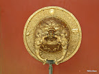
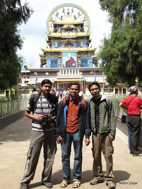
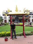
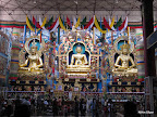
The ride from Mysore  was smooth... Roads perfect. With a double road accompanying us some 30 kms from the city and after that a normal 2 lane road, winding left and right smoothly. By around 11.30 am we reached Bylakuppe. Here we need to take a diversion to the right for some 7 kms for the famous Golden Temple. This Tibetan monastery is very famous in this part of the world and I was wondering why have these refugees settled so far away from their home town. But on a serious note it must be really frustrating to flee ones own land and live in other country where I dont think they feel at home.


Golden Temple-Bylakuppe

As we parked our vehicles and went inside the temple premises , we got to witness the beauty of this place. The entire premises was soothing to ones soul.Also it was interesting to witness the buddhist culture so near to ours but still far apart. Went inside the main temple where there are huge statues (20 feet tall) of Buddha and his various avathara's. Spent nearly 2 hours exploring the premises, explored the gifts shops opposite to the temple and had our first taste of tibetan food. We tasted Veg Momo's, I would say a bit blunt for Indian tastes. Further had  various types of noodles/soup.
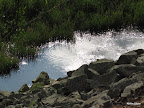
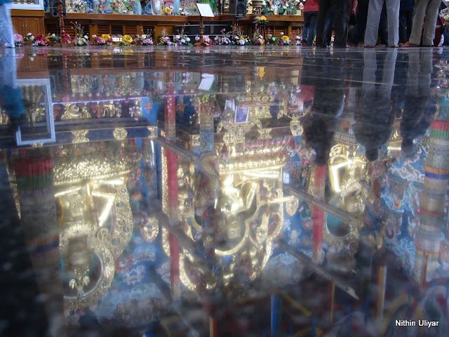


Stone Reflection


At around 2.30 pm we left this place towards Madikeri. The roads on this sides of the ghats were wide , winding and awesome. We rode at a good pace and reached Madikeri and without any stop at this place moved towards Talakaveri , the birth place of river Cauvery which is a good 45 kms from this town. The roads after Madikeri goes to dogs and there are huge craters on the entire path. Took a diversion towards Bhagamandala some 2 kms after Madikeri and the roads become very narrow. The road conditions were decent. Just then the clouds open up and we were caught up in a downpour. We stopped at Bhagamandala and were mulling our options whether to continue towards Talacauvery and further towards Kasaragod the same night. The tea stall guy nearby informed us that the road to Kasaragod is via a dense jungle and it might not be a good idea to ride after dark in such heavy rains.

After a bit the rains subsidized and decided to continue on. We first moved towards Talacauvery , but were stopped at the base by cops saying vehicle moment is banned after 6 pm and it was very close to that. Disappointed we moved on since the views from the top of Talacauvery was simply awesome for both the times I had visited this place.


From Bhagamandala we entered the Talacauvery Reserve forest. This forest is as dense as one could possibly be in the western ghats. There is 6 ft wide single lane road running the entire distance to Panathur. The road condition is decent with few potholes here and there. Soon enough the rains started again and we were riding through the dense forest and by this time the the sun light had completely faded out. Given the small road, absense of sunlight and the dense jungle surrounding us we were getting a feelling of riding through a tunnel, a tunnel made of trees. This ride of around 35 kms to Panathur was simply awesome and the high point of the ride. The vehicular traffic on this road is very minimum and could be counted with ones fingers.  


We reached Panathur which signifies the end of the forest and beginning of Kerala state. From here onwards we were back to civilization. Totally drenched in rain we moved further. But by this time one of the guys received a call of an emergency at home. So he decided to return back to Bangalore by taking some bus or taxi from Kasargod the same day. The road till Kanhangad is good, but after that it was so damn hopeless and added to that vehicular traffic was at its peak making it a forgetable ride. At around 11.30 pm we reached Kasaragod, but the last bus to Bangalore had long departed at 9.30 pm. So having no other option we decided to cut short the trip and return to Bangalore the next day in bikes.
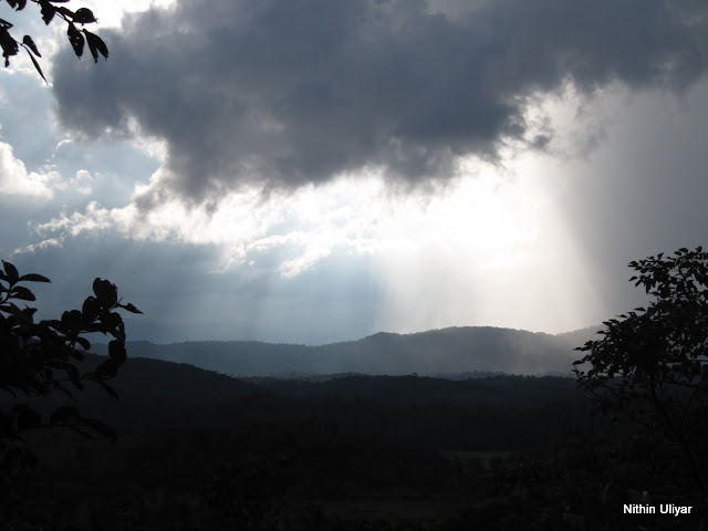
Divine Light


Day 3:
31st Oct 2010
Kasaragod->Jalsoor->Sullia->Madikeri->Mysore->Bangalore (360 kms)
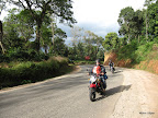
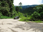
Road To My Moms Place
One of the most popular places to visit is the Bekal Fort some 15 kms from the Kasargod city. I had been to this place some 2 years back and this place is perched right at the coast giving a awesome strategic view of the sea, beaches and the rocks below. An awesome sunset at this place is surely guarenteed. One can explore this place in some couple of hours. The song "Tu Hi Re" from the film Bombay was shot at this place only.
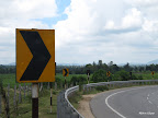
Kasargod-Jalsoor Road

We got up at around 7.30 am and got ready to leave directly to Bangalore without any pit stops enroute. Left Kasargod at around 8.30 am and decided to take the better and shorter route to Bangalore via Jalsoor. Drove on the NH-17 till Cherkala and here we took a left and we were on the awesome road to Jalsoor. I had been on this road so many times, but never on my bike. Again this route is surrounded by dense jungles and small hamlets enroute. After Jalsoor we entered the Mangalore - Madikeri route and this was disappointing. Our pace slowed down a lot negotiating the potholes and the fact that we were climbing up the ghats didnt make matters better. The views at ghats were beautiful as always. After Madikeri the roads become good and from here onwards we had a non-stop ride to Bangalore with pit stops at Kushalnagar for lunch and snacks at Maddur (the famous Maddur vade).

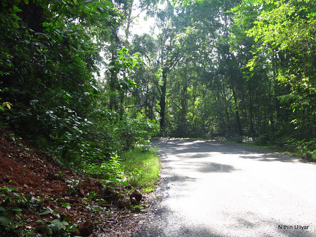
Moon Craters -Sullia to Madikeri Route


The total ride distance on this day was close to 360 kms the longest I have driven in a single day. Even though the others kept swapping, I rode the entire distance since I am more or less scared sitting pillion in a bike when riding at speeds of 70+ :P. And to be frank I was not tired at all, apart from the horrible pain in the bottom due to hopeless pulsar seats offering very little cushioning. We reached Bangalore at around 6.30 in the evening, completing the journey in around 10 hrs.

In the end our biking urges were satisfied. It had been a long time since we had a pretty successful ride and not sure when will we again go on such a long ride. Would like to end this post with a funky quote so appropriate to biking :P

"Riding a bike is like watching a 3-D movie, you get all those special effects which is absent while driving a 4-wheeler"

 
Trip 'O' Meter -> 760 kms
Total Cost Per Head -> Around 1.8 k

Pics Link->
http://picasaweb.google.com/unithinbhat/KasargodRide#
Route Map

October 23, 2010

Turahalli Forest: Lost In My Backyard


Of all the biking trails I have explored, one common factor is that they will be far off from my home and I never had the interest nor the patience to explore trails close by. So when going through a fellow cyclist's blog I came across this place called Turahalli forest, damn close to my house and I was never enlightened about this place before. So on a lazy and cloudy Saturday afternoon couldn't resist the temptation to explore this forest, so off I went alone without any idea about the road directions and relied a lot on the localites.

BSK 6th Stage Road
Directly hit the BSK 6th stage road and the area becomes more or less desolated. Few vehicles and even fewer houses build on this newly developed layout.  Soon started to get the glimpse of the boulders filled forests, the trademark of Turahalli forests. But the main problem was I was not finding any proper access paths into the forest. I had an MTB for gods sake, but the entire forest seemed to be  cordoned off by barbed wires. So on and on I went searching for an access and finally found one , a foot trail which starts from a desolate colony.

The Offroad Trail


Thus started the offroading trail. I would say it was kinda extreme and at many places I lost the trail. So trail or no trail was cycling on any flat piece of land , and at some place had to get down and walk to negotiate huge boulders. Technically speaking I was more or less lost and I was loving it :). Offroading and lost in the jungle , what more can an andreline junkie ask for :P. After exploring aimlessly found a proper trail going to the Turahalli temple. There are infact a lot of peacocks in this forests and I caught sight of nearly 3 of these beautiful creatures.


After I hit the motorable kuccha road there is a very steep climb right up to the temple. And in addition to that my wheels were not getting enough traction while climbing up due to loose sand and stones, so making it somewhat an effort. After I reached the top the views where simply superb. The dark clouds forming above the city of Bengaluru was nice.


Dark Clouds Forming
When I reached the temple at the peak the poojari and some assistant of his where closing up the temple. Striked a conversation with them regarding the routes and stuff. Also they told me to be careful because of lots of thefts happen at this place and I was all alone. I somewhat agree to that because these forests are completely desolate and I didnt come across any human apart from the poojari and his assistant for the entire ride inside the woods.

View From The Top

Temple At the Top
After spending nearly 5 mins at the top left the place. The descent was quite thrilling with the state of the road. You got to be 100% alert when descending such roads. One mistake and you will take a fall. After some 15-20 mins reached the main road and took a wrong turn towards Mysore road instead of Kanakpura road. But even then the detour was total worth it. The bike cam video uploaded was on this road.

[Bike Cam - Next time got to focus more on the views than the roads :P]

After I was informed I was travelling in the wrong direction took a U turn and reached Kanakpura road and finally reached my house at 3 pm. You wouldn't believe my timing becoz as soon as I entered my house it started to rain very heavily. Even if I was slower by 30-40 secs would have surely got drenched :).

Road to Turahalli from the Vajarahalli Road
Overall a good ride and the weather was awesome and so was the trail. Got to explore these forests still more, but with some company after being warned by the poojari.

Figures:

Trip 'O' Meter -> 25 kms (cycling and walking)
Time Taken -> 1 hr 50 mins
Average Speed -> 13.63 km/hr

P.S. -> Mobile Phone Pics
P.S. 2 > Got my first flat after this ride :P
Route Map- Red Circle Represents Extreme Offroading No Defined Paths, Brown Circle represent the normal kuccha roads

October 17, 2010

The Lost Symbol


 Not one , nor two but three times... Thats the number of times Robert Langdon escapes from certain death and you thought Bin Laden was lucky. After the Angels & Demons, Da Vinci Code , Dan Brown is back with Robert Langdon's character in this book. As with the previous 2 books this too is loaded on symbolism, ancient legends and mysteries. Now it is the turn of Masons, after focusing on Illuminati and Knights Templar.

If one examines all of Browns books one come's to a conclusion of a common skeleton plot he employs in all his books. This is not restricted to books about symbolism and ancient mysteries but also includes books like Deception Point(one of my favorites) and Digital Fortress. This skeleton plot has a killer/assassin who is on a rampage and with all probability you will witness some sort of murder in the beginning of the story and from here the story builds on. 

Story starts with Robert being summoned to the capital of the United States by his mentor(Peter Solomon) and close friend. But everything is not what it seems. He is  lured into a trap by an assassin who has kidnapped his mentor and asking for Roberts help in cracking the age old Masonic treasure in exchange of Peter's life. So starts the journey and the adventure cracking age old codes, symbols and what not.

The book was a lot more predictable , with the so called twists and turns not providing the necessary surprises,  many of which I got a clue before it was revealed. Reading the last 30 pages was really a pain in the ass and the ending a big anticlimax. Overall a book which can be read atmost only once and that too better to borrow a copy from some friends or library. Not worth spending your hard earned money on this disappointing piece of literature. Probably the title "The Lost Book" would be more fitting for this !!!!!!


October 8, 2010

Operation Kumaraparvatha : Men vs Wild


Of all the trekking destinations in the Western Ghats, the one which stands apart and is considered to be the Mecca of avid trekkers is Kumaraparvatha a.k.a. Pushpagiri. The most common conversation between 2 South Indian trekker's will be like "Hi, How are you ??? Have you done KP???!!!" :D and those who havnt done it are looked as second class citizens :D.  Considered to be the toughest trek of its kind South of Sayadhri hills for a long time till the likes of Ombatthu Gudda were discovered and frequented by the nature lovers. Standing at 1712 m above sea level and being the 3rd tallest peak in Karnataka this one is not to be taken lightly.

As the term "uncertainty" is associated with treks of such kind we had to endure it much before itself with the verdict of the Ayodhya issue playing a potential spoiler. But in the end everything fell into place and peace prevailed. I heard a quote somewhere "If you cant convince them, confuse them" :P... totally apt here :). Finally 7 dudes(Praveen, Prasanna, Harish, Vineeth, Raghav, Harsha and Myself) were ready to take on the Kumaraparvatha challenge and return as real men :D :D... Obviously I watch too many action movies :P.

Day 1(2nd Oct 2010) : The Uplink 


We had caught the 11pm bus from Bangalore the previous day. The bus journey in the "rickety" Rajahamsa bus was far from comfortable, but we had left the material comforts back in the city so no complains in there. The bus reached at 6.15 am and we had nearly 1 hr before we could catch the bus to Bidahalli. So we went to a canteen nearby(Just opp the KSRTC bus stand) and had our breakfast and also packed some for our lunch. Caught the 7.15 bus to Bidahalli(almost 30 kms from Somvarpet) and at around 8.30 we were at the starting point of the trek.

Kumaradhara

The initial part of the trek takes us through a motorable road and walking the 5kms from Bidahalli to Hegde Mane was just a walk in the park. Enroute we came across the Kumadhara river flowing underneath a bridge. There was actually no visible approach road , but we all wanted a refreshing dip in this isolated stretch of the river. So pretty determined went exploring through thick bushes in search of a route down, and even though I fond my way to a cozy spot , myself and the others who soon followed were soon swarmed with leeches. The first for many to come for the entire trek. Spent an hour or so in the freezing and refreshing waters.

Heggade Mane


We reached Hegde Mane and this is a very small village and we caught sight of very few villagers and lots of dogs. Literally we were welcomed by barking dogs in this village :P. This village had greenery everywhere and a major chunk of it was the paddy fields. Simply a feast to the eyes. As we moved further we were slowly and stealthily engulfed in mist. Further we continued on this road till we reached a temple.(Got to take a right here) From here the road becomes rustic and couple of km's down  we reach the forest check post. Just at this time some other group also joined us and believe me they were traveling very light , no tents, no sleeping bags and some even had no shoes and they were having plans to climb up and down the peak in one single day. After we overtook them it was the last we saw of them :). Rookies :P.


A Pup at the checkpost
At the checkpost we were welcomed by the forest guards and they collected 115 bucks per head (which is legal money :P) . Also the guards were giving us mixed signals when we informed that we were camping on the top. Anyway in the end they were convinced seeing our level of preparation , having tents, sleeping bags, food and anti leeching agents the 4 primary pillars on which this entire trek depended on. From the checkpost we entered "Pushpagiri Wildlife Santuary". The path was through dense canopied jungles. Since the monsoons were nearly coming to an end it made a perfect spot for the leeches to survive in their dream land. 

Hanging Bridge Near The Forest Checkpost
 

On and On we went along the trail which is clearly marked by yellow colored sign boards, de-leeching at regular intervals which if unchecked for some time would make your shoes look like Medusa's head with all those one ended leeches swaying enjoying the free ride. Also like to add there is no fool proof way to avoid leech bites. However complex your preparation is,  these bloodsuckers will surely find a way to drink that elusive nectar. This I have found out first handedly :(.

Sign Boards Giving the Info

By this time Prasanna was starting to loose some steam and was beginning to fall behind. At one point we came across a pretty steep rock section and me and Prasanna were the trek buddies at the time. As soon as we reached the foot it started to rain and this didnt make matters better on the already slippary rain exposed rocks. Slipping and crawling on all fours we started to climb. Prasanna who was ahead of me took a wrong turn and he was at a point of no return. Somehow with help of sticks, twigs and courage from Prasanna's side was able to pull him to safety.

Necklace of water pearls
After this section we met another group of 7 trekkers climbing towards the peak. It was now raining very frequently and believe me , witnessing a rain in the middle of a rain-forest is really an awesome sight. Everything looks so green and lively :). This path was either through dense jungle or through open slippary rocks. Finally after covering 7kms of this path we almost reached the top, completely drenched. At this time I checked my legs and was surprised to a see a large blob of blood on my white socks. When i checked it out found out 4 leeches feasting on my blood and 3 of them feasting in one single spot. I guess they have heard of the phrase "family get-together" :P.


We reached the top at around 4pm. At this time we couldnt get any views with clouds blocking everything.We erected the tents (with one of them damaged to the brim- didnt expect BMC to do tat :( ) and as soon was done we were inside it. Even at the top there is constant presence of the leeches in-spite of lack of any trees. And this being our camp ground we made doubly sure to protect our forts from the leech onslaught. But I dont know how they did it , but they always ended up inside the tents, especially Prasanna getting 5 bites inside the tent. Its surely the highest bite rate one could get inside a small area as in a tent :P.

But just as the sun was about to go down the clouds cleared up considerably with us getting to view a GLORIOUS sunset, that too which we didnt expect in the monsoons. A fiery red ball of flame and simply beautiful. Makes all the effort by us puny. Something to remember for a lifetime. 

A Glorious Sunset

The other group had got just a huge tarpaulin cover to protect them from the rain and the wind. I didnt know whether to laugh or feel sorry for them , but they were alive and kicking the next morning :P. Our tents on the other hand were pretty congested with us not even able to stretch our legs. Had a not so OK sleep with constant rain throughout the night and water seeping through the tents.


Day 2 (3rd October 2010): The Downlink


Woke up pretty early in the morning with the first rays of the sun. Were treated with some spectacular scenery even though we couldn’t get to view the sunrise because of all the clouds , but even then the cloud formation was superb. There were 2 layers , one layer in lower elevation than us and one which was at higher elevation. This “sandwich”  was simply nice with at some points some mountains poking their heads out of the cloud cover and the sun playing hide and seek behind this cover.  From the top you could actually see western ghats forests spread to such a huge distance, so many hills/mountains in view, so many yet to be explored by us. But one thing was for sure, we had conquered the tallest peak in our line of sight, we were the champions. J

The Lone Tower


After loitering around the peak for some 2 hrs we decided to descend via the Subramanya side. But the route down was not properly marked. This confused us a lot. Also at some points just below the peak we get airtel/Vodafone signals. But it seemed like we were the only early birds on a Sunday morning. Anyway at one point there is board displaying “Water Source 0.5 km” just below the peak and this the actual route which takes us towards Subramanya route. The initial part of the descend was pretty much along a path of the water falls so it was pretty slippery. At one point we reached a point where there was a huge rock drop and no further path was visible. But thanks to some initiative taken by some daredevils of the other group we were able to discover the path. After a couple of kilometers descend via dense forest we were led into open grasslands. This views were in complete contrast to what we had witnessed the previous day and some breathtaking drops.

Wild Flowers


Apart from the spectacular views the climb down was pretty event less ignoring the tired and complaining legs. We reached the Kallumantapa perched in middle of the grasslands and offering some solid shelter. A point to be noted is that in this time of the year, you will never run out of water during the KP trek. There are numerous streams, rivers , springs strewn across the entire path. So there is one thing less to worry about. After a brief rest we continued along this grasslands nearing to the Bhatru Mane and Forest Check-post at Girigaddhe and finally reaching check-post with the sun directly above our head.

The Unofficial Suicide Point
After providing the receipts which we got from Bidahalli checkpost we proceeded towards Bhatru Mane and had a simple meal of rice , sambhar and buttermilk which believe me we were happy to gulp down after 1.5 days without proper meal. Our host Nagesh Bhat was a pretty amusing character. Cracking jokes with the trekkers , getting to know the people. It must be pretty unnerving to live so far from civilization without any proper access.


After the meal we thanked our host and moved on along our journey. Some 2kms down the lane we again encountered a leech infested forest all the way to Subramanya. And considering the residents of Bhatru mane have to traverse through the same path even for a visit to the nearest store which doesnt make sense to us city folks, so used to convenience.


The Kallumantap
As we were climbing down via the forests the sky’s opened again it again started to rain and this made the progress a bit slow. Finally we reached the starting/ending point of the trek at nearly 3.30 pm. By this time we came to know that Prasanna was suffering from some ankle injury and he and Vineeth were coming slowly and taking it very easily. So it was decided that me and Raghav would continue towards Subramanya and book rooms to get freshened up.

Bhatru Mane
One by one everyone arrived at Subramanya and we now had nearly 3 hrs to kill. So we decided to pay visit to Subramanya temple, had dinner and finally boarded the 8.45 pm bus to Bangalore. Overall a trek where we least expected any views, but we wanted seclusion in nature as well as enjoy the greenery everywhere.And we were not at all disappointed in any way, got a lot more than we expected :).

Subramanya With KP in background

 Finally would like to add the following quote (by myself :)) "The easiest way to get a high is by pushing your own boundaries" and this is totally appropriate in this journey. We pushed our boundaries not just physically but mentally too, went to places where we had not gone before, saw things which we witnessed only in some documentaries, expanded our skills of surviving in the wild and by doing this we got high and believe me once you get addicted to this high, it is hard to get rid of it :). And this high is far better than any substance abuse can give you, and more importantly doesn't come with a hangover :P.


Group Pic

Trek Details:

Trek Distance->
Bidahalli->Hegde Mane->Forest Check Post = 7 kms (this can be avoided if having a private vehicle)
Forest Check Post -> Pushpagiri Peak -> Girigaddhe Check post/Bhatru Mane = 14 kms (7+7)
Bhatru Mane -> Trek Starting/Ending Point -> Subramanya Temple = 7 kms (5+2)

Total Trekked Distance -> 28kms
Total Cost Per Person -> 1.2 K
Bhatru Mane Contact No -> 9448647947/9480230191 (Got to book food or accommodation in advance)
Mobile Signal Info---> BSNL,Vodafone,Airtel at the peak

Snaps Link->

http://picasaweb.google.co.in/unithinbhat/Kumaraparvatha
Related Posts Plugin for WordPress, Blogger...