June 30, 2017

Noosa National Park


Noosa is one of the more popular beach vacation towns in the south east region of Queensland, and we learned that the hard way during a visit on an extended weekend. We visited this place on the Good Friday weekend, and boy this place was crowded with no parking spots available anywhere. In the end after roaming for close to an hour trying to find a parking spot, we did park in a place but did end up with a fine :P.


The best spot in Noosa is definitely exploring the walking trails of the Noosa National Park, which runs along the coastline providing some awe inspiring views. There are multiple trails running through the national park (map here). We decided to take the much popular coastal track upto Hells Gate and return back via some shortcut. The day was perfect with mild temperature and sunny day, making it an enjoyable day for walking. The water right from the Noosa Heads was glistening under the sunshine in turquoise blue colour. Our plan was to walk around 5 km return.


The initial park of the walk is close to sea level, but slowly the elevation increases with the highest point being near the Hells Gate. The views on the other hand are spectacular and the best views again at Hells Gate, which gives a birds eye view of the Alexandria Bay. Apart from the views it was quite windy. Probably this would be a great lookout point for whale watching during the migration period. We then returned back and it took us close to 2.5 hrs for the entire walk.


Once we returned back from the walk we went to Laguna Lookout point which gives a birds eye view of the entire Noosa Heads area and the river. Spent time relaxing here and had our lunch. This spot was sparsely frequented by tourists.


The finale for our trip was to enjoy the waters of the Noosa Main beach. Luck finally smiled on us and we got a parking spot easily when we were at the right place at the right time. Others waiting along with us where not so lucky :P. We enjoyed the waters of the main beach, eventhough the waves were quite rough.

June 27, 2017

Bushwalking in Mt Glorious


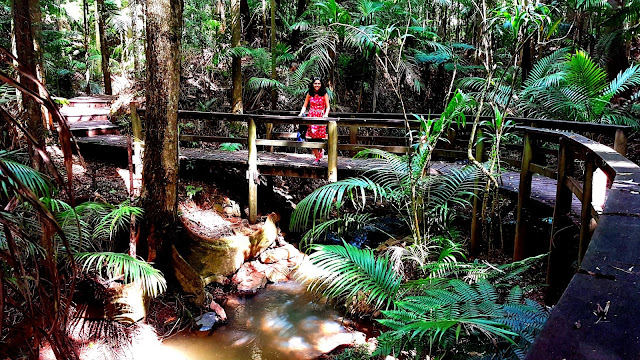
Mt Glorious is one of the nearest rainforest bushwalking tracks from the city of Brisbane, with it just being 40 kms from the city centre and a perfect getaway on an unplanned weekend. We had visited this area just the week after the cyclone Debbie had hit the Queensland coast and we could see a lot of damage on the road upto the Maiala Picnic area from where the track starts and also on the bushwalking track itself with lots of tree debris strewn across it, making it a bit of an obstacle race :).


Maiala Picnic area has plenty of parking spots and the drive upto this place is quite picture-some. This spot is a perfect spot to spend an afternoon with family and friends even if one is not interested to go bushwalking.  Also from this place the Greene falls circuit starts , which is a 4.3km easy grade walk with not so difficult gradients. We took an hour of walking at a leisure pace to reach the falls and enjoyed it. The Greene falls is a decent sized waterfalls, nothing spectacular , but still good in its own right.


Once back from the walk we had our lunch and relaxed by the grasslands of the picnic area. The next stop was the Wivenhoe Dam which is the source of drinking water for the city of Brisbane. Enroute to this place we also came across a lookout area up in the hills having a birds eye view of the entire Wivenhoe dam catchment area. We went upto the dam and to one of the visitor centers. From here one can get into water and enjoy the pristine water of the dam. Overall a great place to visit on an unplanned weekend.

June 3, 2017

Springbrook National park


Springbrook is the one of the most well known part of the ancient Gondavana rainforest and listed as a world heritage site. In this forest the route through the hinterland of the Gold Coast is the most enjoyable part of the journey.


Our first stop was the Purling Brook falls. The viewpoint for this falls is just a few 100 metres from the parking area. We parked our car and went to the viewing platform saw the falls dropping into a deep canyon. There is even a 4km walking circuit which goes all the way to the bottom of the falls and is considered a bit strenuous. Since the amount of water was less, it was not attractive enough for us to go all the way down to the base of the falls. This falls would definitely look majestic soon after heavy rains.


Near the falls are 2 lookout points. The first is the Canyon lookout which is just off the road and gives great views of the city of Gold Coast. The lookout is literally named as "The Best Of All Lookouts" and requires a 10 min walk from the parking area. This route takes one through some ancient forest and also one comes across ancient Antarctic Beech trees along the way. The best of all lookouts looks into the state of New South Wales and lives up to its namesake.


The next stop was the natural bridge, wherein the water falls through a natural hole having an awesome cavelike setting. This natural cave is also home to glowworms and certain guided tours are conducted after sunset. There is a walking track which took us first inside the cave , then above it from where one can see the water entering the hole and then back. It was a very good place to explore.


On our way back we stopped at Hinze Dam, which is the source of water for the city of Gold Coast and a pleasant place to visit. One can literally walk for miles on the embankment with water and greenery on one side. There are even some barbeque and play areas. After this it was time to return back home. 

April 14, 2017

Byron Bay : The Easternmost Point Of Australia


Australia is the land where the sun rises much earlier than majority of the civilized world and that makes it distinctive. But alas that was not enough for us. We wanted to visit the place where the sun comes up first, than the rest of the Australian landmass. The beautiful Byron Bay is the answer to it, the easternmost point of Australia. Byron Bay is around 160km from Brisbane on the Pacific Highway and beyond Gold Coast and in the state of New South Wales.


Since we wanted to catch the sunrise, we decided to drive to this place the previous day itself and camp for the night. It is illegal for one to camp unless in designated camping parks, where one is provided with site for camping, toilets, garbage bins etc to make it more eco friendly. Since we were visiting on a long weekend we could get one in Byron Holiday Park, which was decent enough, but not the best. Once we had settled and pitched our tents, we decided to visit the Tallows beach in the backyard of this holiday park. It is a good 2km walk from the park, taking us through some picture-some backwaters and grasslands. The Tallows beach on the other hand was huge and simply beautiful, with the Byron Bay lighthouse in the left end of the long beach.
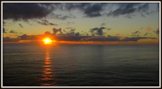
The next day we got up early before sunrise and drove all the way to the Cape Byron Lighthouse, which is the best place to catch the first rays of the sun. But unfortunately many other tourists too had the same idea and with very limited parking space near the top, it took us some time to find a spot, much further down the hill and walk all the way back. We were just in time to catch the views. The sky was not clear, but still we got some good views. Once the sun rose we explored the Lighthouse trail which starts from the Light house, hugging the coastline, giving some awesome views of the coast and the endless ocean.
After checking out from our camping site, we decided to visit the main beach of Byron Bay, which was buzzing with activity. We enjoyed in the crystal clear waters of this beach, along with a large number of others who were there to enjoyed the pristine water even though we found a large number of mildly lethal blue bottle jellyfish carcasses washing ashore. After spending close to 2 hours in the water, we decided to explore the hinterland. We had lunch in a local Indian restaurant (Bombay to Byron) which was average, even after having such a unique and interesting name.
The two places we had decided to visit in the hinterland were the Minyon falls and the Rocky creek dam. The Minyon falls is around 35kms from the town, but the last 3-4 kms of the road leading to the falls is bad, unpaved and bumpy. Eventhough our sedan could take this road, it was a surprise coming across such a thing leading to a popular tourist attraction. Despite the roads being disappointing, the water falls was not. The cliff through which the water takes a plunge is very steep and easily gives one an episode of vertigo. According to my estimate it was easily a 150m fall, with near vertical mountain walls flanking it. I presume it might be a mecca for rock climbers.
From the falls we moved towards the Rocky Creek Dam which is another 20kms. This dam supplies water to the town of Byron Bay. There are a lot of trails along backwaters of this dam. We spent some time exploring this area and then it was time to return back to our base.

April 9, 2017

Lamington National Park

Lamington is one of the lesser known national parks in the Gold Coast hinterland, especially in comparison to its well known siblings such as Springbrook and Tamborine national parks. The infrastructure here are a tad lesser than the surrounding parks, which infact adds to the charm of the place, making it more in sync with the wilderness. This park has a narrow one lane road through the forest and very limited parking spots for those interested to explore this area. But that was exactly what made the drive through the rain-forest simply mind-blowing.


We had decided to explore 2 bushwalking trails. One which explores the Moran falls and the other which leads to the view from the Python rock. To reach the starting point of these trails one has to start towards O'Reilly's Rainforest Retreat, which is a resort in the middle of this rainforest. Just before one reaches this resort there is a small parking lot which signifies the start of both the trails. The left trail leads towards the falls and the one leading to the right leads towards the view point.


We decided to explore the falls trail first, which is 4.4km return and goes through some decent elevation. Initially one gets the frontal view point of the falls and trail further leads to the top of the falls and also giving some good views of the valley forged by its water. Moran falls was with decent amount of water, testament to the recent rains which had lashed these regions. But there is no opportunity to get into the water either on the top or at the foot of the falls.


We returned back after taking close to 2 hrs and then we moved on towards the Python Rock trail. The return distance of 3.1km to the Python Rock goes through fairly flat terrain and can be completed in an hour. The views we got from this point was simply mindblowing especially of the rain laden clouds condensing over the nearby mountain ranges. Overall the hinterland regions of Gold Coast are a good place to visit especially in the peak summer, when the temperatures here are atleast 5-6 degrees cooler than the plains.

Related Posts Plugin for WordPress, Blogger...